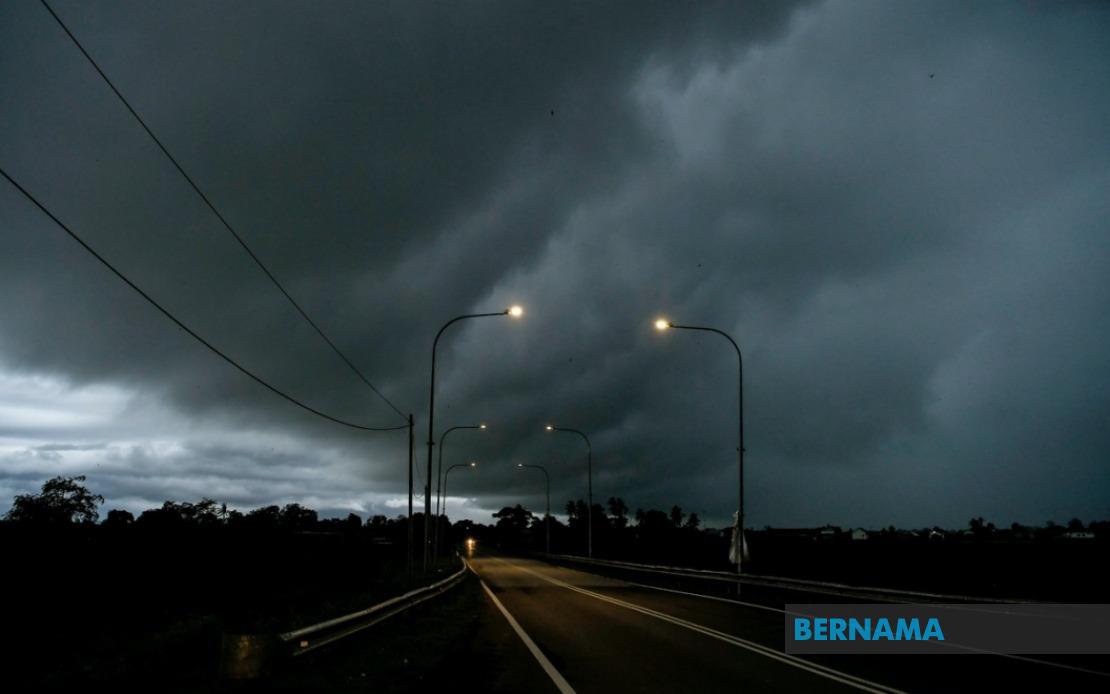
The Malaysian Meteorological Department has extended a weather alert across a significant portion of the country, cautioning residents in nine states and the federal territory of Labuan to prepare for potentially hazardous atmospheric conditions through the evening hours. The alert, which carries warnings for thunderstorms, heavy rainfall, and strong winds, encompasses diverse regions spanning from the northern peninsula through to East Malaysia, indicating a widespread weather system affecting the nation.
In the northern peninsula, the entire state of Perlis falls under the alert zone. Kedah is partially affected, with the warning applying specifically to the districts of Langkawi, Kubang Pasu, Kota Setar, Pokok Sena, Padang Terap, Sik, and Baling. This geographic specificity reflects how meteorological departments now target warnings to affected areas rather than blanket alerts, allowing residents to make more informed decisions about their immediate surroundings.
Perak likewise experiences the alert in selected districts, namely Kerian, Larut, Matang and Selama, Kuala Kangsar, Kinta, and Kampar. These areas, which include major population centers and industrial zones, may experience disruptions to transportation and outdoor activities if the predicted conditions materialize as forecast. The central peninsula is also affected, with warnings covering Cameron Highlands, Bentong, Bera, and Rompin in Pahang, plus Hulu Langat in Selangor and the Jelebu and Jempol areas of Negeri Sembilan.
The southern peninsula is not exempt from the meteorological department's caution. Johor residents in Segamat, Kluang, and Mersing are advised to remain vigilant, as these regions sit along traditional storm tracks during seasonal weather patterns. This broad geographic spread across both coasts and interior regions of peninsular Malaysia suggests the weather system has significant geographic extent and the potential for serious impact across multiple population centers simultaneously.
Sarawak faces particularly extensive warnings, with multiple districts placed on alert. The affected areas include Kuching (specifically Bau and Kuching proper), Serian, Samarahan (Samarahan and Asajaya), Sarikei (Meradong), Sibu, Mukah (Tanjung Manis), Kapit (Song and Kapit), Bintulu (Tatau and Sebauh), Miri (Marudi), and Limbang. This coverage reflects the expansive geography of Sarawak and the varied microclimates across the state, from coastal areas to inland regions. The state's maritime communities and agricultural zones would face particular vulnerability to heavy downpours and strong winds.
Sabah completes the geographic picture of affected regions. The interior districts including Sipitang, Kuala Penyu, Beaufort, and Tambunan have been included in the warning, along with the west coast areas and the Sandakan divisions of Tongod and Kinabatangan. These regions, particularly the interior zones, can experience rapid weather deterioration and challenging drainage conditions during intense rainfall events, posing risks to both residents and infrastructure.
The temporal constraint of the alert—effective through 9 PM on the date issued—provides a clear window for residents to prepare and for authorities to coordinate response measures. This evening deadline suggests the meteorological department anticipates the system will either weaken or move beyond Malaysian territory by nightfall, though conditions could persist beyond the official alert period in some locations. Residents and businesses are typically advised to secure loose outdoor items, avoid unnecessary travel during the worst of the weather, and monitor official updates from the Malaysian Meteorological Department for any extensions or modifications to the alert.
Thunderstorms of the nature described in the alert carry multifaceted risks. Heavy rainfall can rapidly overwhelm drainage systems in urban areas, leading to localized flooding that disrupts traffic and commerce. Strong winds associated with convective systems can damage structures, down power lines, and endanger outdoor workers. Lightning strikes pose direct hazards to exposed individuals and equipment. For maritime communities and offshore industrial operations, the combination of strong winds and rough seas compounds safety concerns. Agricultural areas may experience crop damage, while the tourism industry in affected regions could see visitor disruptions.
The breadth of this alert reflects the importance of the monsoon seasons and the complex atmospheric dynamics across Malaysia's varied topography. The Malaysian Meteorological Department's decision to issue warnings for specific districts rather than entire states demonstrates increasingly sophisticated forecasting capabilities, allowing authorities and residents to calibrate their preparedness appropriately. Nevertheless, the involvement of nine states and a federal territory underscores how weather systems can affect vast areas simultaneously, requiring coordinated awareness and response across multiple jurisdictions and administrative boundaries.
For Malaysian readers and those with interests in the affected regions, maintaining awareness of official meteorological updates during the alert period is essential. Timely access to information from MetMalaysia through official channels, emergency alerts, and news outlets can mean the difference between minimal disruption and significant hardship. The alert serves as a reminder of Malaysia's exposure to intense tropical weather systems and the need for year-round preparedness, particularly during seasons when convective activity intensifies across the region.

%22%2F%3E%3C%2Fpattern%3E%3C%2Fdefs%3E%3Crect%20width%3D%22100%25%22%20height%3D%22100%25%22%20fill%3D%22url(%23ph523ndg)%22%2F%3E%3Crect%20width%3D%22100%25%22%20height%3D%22100%25%22%20fill%3D%22url(%23ph523ndp)%22%2F%3E%3Ctext%20x%3D%2250%25%22%20y%3D%2250%25%22%20text-anchor%3D%22middle%22%20dominant-baseline%3D%22central%22%20fill%3D%22rgba(255%2C255%2C255%2C0.95)%22%20font-family%3D%22Georgia%2C%20'Times%20New%20Roman'%2C%20serif%22%20font-weight%3D%22700%22%20font-size%3D%22272%22%20letter-spacing%3D%22-0.02em%22%3EAnwar%3C%2Ftext%3E%3C%2Fsvg%3E)