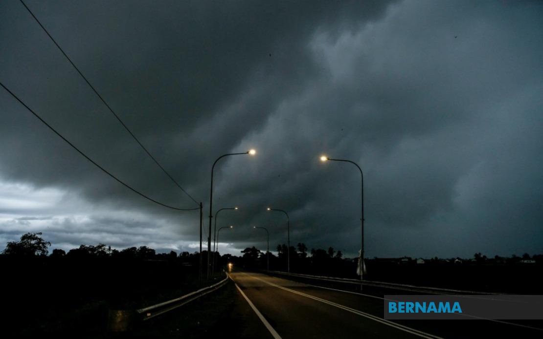
The Malaysian Meteorological Department has activated a nationwide weather alert, cautioning residents across multiple regions to prepare for hazardous atmospheric conditions over the next several hours. The alert encompasses significant portions of both Peninsular Malaysia and East Malaysia, reflecting the extent and intensity of the developing weather system. Residents in affected areas should remain vigilant and take appropriate precautions as conditions are expected to remain dangerous until 1 am the following day.
In Peninsular Malaysia, the western and northern regions face particular vulnerability. The alert covers specific districts in Kedah, including the areas of Padang Terap, Sik and Baling, where severe electrical activity and substantial precipitation are anticipated. The neighbouring state of Perak has also been placed under warning, with the inland district of Hulu Perak identified as a risk zone. On the east coast, Kelantan faces an extensive alert spanning five separate districts: Tumpat, Pasir Mas, Jeli, Tanah Merah and Kuala Krai, indicating widespread exposure across the state. Pahang's interior district of Jerantut similarly falls within the danger zone, suggesting the weather system is tracking inland with considerable force.
The situation in Sarawak reveals a particularly expansive threat pattern, with nearly half the state experiencing some degree of weather alert coverage. The capital city of Kuching and surrounding regions including Serian and Samarahan face the immediate danger. The alert extends southward to Sri Aman and the border districts of Betong, encompassing both Pusa and Betong proper. Central Sarawak is equally affected, with alerts covering Sarikei's Julau district and Sibu's outlying areas of Kanowit and Selangau. Kapit and its surrounding regions, including Bukit Mabong, remain on high alert. The northern districts of Miri experience particular concern, with warnings covering Subis, Beluru, Miri town and the remote district of Marudi. Even Bintulu and Limbang along the coast and border regions face predicted severe weather conditions.
Sabah's warning coverage, while more geographically concentrated than Sarawak, highlights vulnerable population centres and interior regions. The West Coast districts of Putatan and Ranau, which include significant residential and agricultural areas, are placed on alert due to their exposure to the incoming system. The Interior's Kuala Penyu and Sandakan's distant districts of Telupid and Beluran are similarly warned. The federal territory of Labuan, positioned strategically in the Sulu Sea, rounds out the warning zone, indicating the atmospheric disturbance has sufficient geographic reach to affect offshore locations.
Thunderstorms of this magnitude and geographic extent pose multiple simultaneous hazards to communities and infrastructure. The combination of heavy downpours, electrical discharge and gusty winds creates compounded risks. Flash flooding becomes a primary concern in low-lying areas and districts with inadequate drainage infrastructure, particularly in urban fringe zones where development has altered natural water flow patterns. Residents in flood-prone localities should avoid unnecessary travel and refrain from crossing swollen watercourses. The strong winds component of the alert carries its own dangers, potentially causing structural damage to poorly secured structures, uprooting vegetation, and creating hazardous driving conditions, especially for high-sided vehicles.
The electrical component of the storms demands particular awareness. Lightning strike risks increase significantly during the alert period, making outdoor activities and work involving electrical equipment or metal structures inherently more dangerous. Historical data from severe weather events across Malaysia demonstrates that lightning accounts for a notable proportion of weather-related fatalities during monsoon and inter-monsoon transitional periods. Communities should ensure vulnerable populations, including children and the elderly, remain indoors and away from windows and electrical appliances during the peak activity hours.
For transportation networks, the alert carries serious implications. Road conditions will deteriorate rapidly as rainfall accumulates, reducing visibility and traction. Airlines may experience delays or cancellations, particularly affecting regional connections serving smaller airports in the interior regions of Sarawak and Sabah. Maritime traffic, especially smaller vessels and those operating in coastal waters around Labuan and the Sarawak coast, should exercise heightened caution or consider temporary sheltering. Public transport operators may face scheduling disruptions, and commuters should anticipate delays when planning essential travel.
Agriculture and environmental sectors face potential short-term disruptions. Farmers engaged in harvesting or field preparation work should pause operations and secure loose materials and equipment. Livestock should be moved to sheltered locations. The heavy rainfall, while beneficial for water resources and agricultural moisture, may damage standing crops and cause soil erosion on hillsides. Plantation operators managing mature palm or rubber estates should assess storm readiness, as wind damage to commodity crops translates directly into economic losses for rural communities dependent on export agriculture.
Public utility providers have presumably activated contingency protocols ahead of the warning period. Electrical utilities typically increase emergency response staffing during severe weather events anticipating power disruptions from lightning strikes, falling branches or equipment damage. Water authorities monitor dam levels and spillway conditions, particularly in catchments receiving the forecast heavy rainfall. Emergency services, including fire and rescue departments, typically place personnel on standby during active thunderstorm warnings, prepared to respond to incidents involving flooding, lightning injuries or wind damage.
The geographic scope of this particular alert underscores how regional weather systems can create simultaneously hazardous conditions across vast distances. The affected areas span roughly 900 kilometres from north to south across the peninsula, and an equally impressive distance across East Malaysia. This geographic extent suggests a substantial weather system, potentially associated with inter-monsoon transition activity or localised convergence patterns that channel moisture and energy across multiple states. Understanding these larger meteorological patterns helps communities anticipate not only the immediate threat but also plan for the possibility of repeat events during similar seasonal periods.
Residents and businesses should remain attentive to MetMalaysia's updates during the alert period, as conditions may intensify, abate or shift geographically. Mobile phone alert systems and traditional weather channels provide the most reliable real-time information. Those with outdoor responsibilities or working in exposed environments should consider postponing non-essential activities until the alert expires. The one-hour buffer until 1 am provides communities with a clear timeline for securing properties, completing preparations and ensuring family members are safely sheltered before conditions potentially reach their most severe.

%22%2F%3E%3C%2Fpattern%3E%3C%2Fdefs%3E%3Crect%20width%3D%22100%25%22%20height%3D%22100%25%22%20fill%3D%22url(%23ph523ndg)%22%2F%3E%3Crect%20width%3D%22100%25%22%20height%3D%22100%25%22%20fill%3D%22url(%23ph523ndp)%22%2F%3E%3Ctext%20x%3D%2250%25%22%20y%3D%2250%25%22%20text-anchor%3D%22middle%22%20dominant-baseline%3D%22central%22%20fill%3D%22rgba(255%2C255%2C255%2C0.95)%22%20font-family%3D%22Georgia%2C%20'Times%20New%20Roman'%2C%20serif%22%20font-weight%3D%22700%22%20font-size%3D%22272%22%20letter-spacing%3D%22-0.02em%22%3EAnwar%3C%2Ftext%3E%3C%2Fsvg%3E)