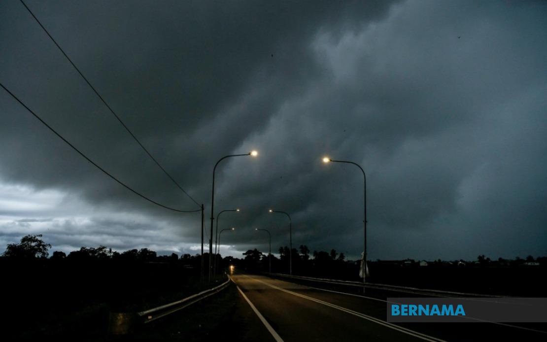
The Malaysian Meteorological Department has alerted the public to potentially hazardous weather conditions developing across a substantial swathe of the nation, with thunderstorms and heavy precipitation expected to sweep through numerous districts until noon today. The warning encompasses significant population centres and rural regions spanning Peninsular Malaysia, the East Malaysian state of Sarawak, and the Federal Territory of Labuan, prompting residents and commuters to exercise caution during the forecast period.
Northern Peninsular regions face particularly acute risks, with the alert covering multiple districts in Kedah including Kuala Muda, Baling, Kulim and Bandar Baharu, whilst the entire state of Penang braces for severe weather. The timing of this warning is crucial for the region, as these areas typically experience significant pedestrian and vehicular traffic during morning hours, and the combination of thunderstorms with strong winds could disrupt daily routines for hundreds of thousands of residents.
Perak's western and central zones form another focal point of concern, with the meteorological department identifying Kerian, Larut, Matang and Selama, Manjung and Bagan Datuk as vulnerable localities. These districts, spanning both coastal and inland terrain, face elevated risks from flash flooding in low-lying areas, a recurring challenge during the southwest monsoon season when localised heavy rainfall can overwhelm drainage infrastructure within compressed timeframes.
The alert extends southward into the central peninsula, capturing Rompin in Pahang and critical localities in Negeri Sembilan such as Jempol and Tampin. Southern Peninsular regions are similarly affected, with Melaka in its entirety classified as at-risk, alongside six significant Johor districts: Tangkak, Segamat, Muar, Kulai, Kota Tinggi and Johor Bahru. This geographical spread underscores the scale and intensity of the atmospheric disturbance pushing across the country, potentially affecting transportation networks, commercial activities and public safety across multiple state boundaries.
East Malaysia faces comparable conditions, with Sarawak's coastal communities in Bintulu Division, specifically Tatau and Bintulu, designated under the warning alongside Miri Division districts of Subis, Miri and Marudi. The Federal Territory of Labuan, strategically positioned in the Brunei Bay, remains vulnerable to the convective systems generating heavy precipitation and associated hazards including lightning strikes and sudden wind gusts that could imperil maritime operations and offshore activities.
The meteorological department's advisory specifically highlights three concurrent weather phenomena: thunderstorm activity, heavy rainfall and strong winds, each presenting distinct operational challenges. Thunderstorms pose electrocution risks to outdoor workers and disrupt communication systems. Heavy rain intensifies flooding dangers, particularly in urban areas where drainage capacity may be insufficient during peak downpour periods. Strong winds threaten structural stability, creating hazards for construction sites, awnings and outdoor installations, whilst complicating navigation for maritime vessels and potentially grounding aircraft operations.
For Malaysian commuters and businesses, such widespread weather warnings necessitate contingency planning. Schools, offices and commercial establishments in affected areas should anticipate disruptions to transportation schedules, with public transport operators typically implementing revised timetables and heightened safety protocols during adverse weather. Motorcyclists and cyclists face elevated accident risks when road surfaces become slippery, and visibility reduces dramatically during heavy downpours.
MetMalaysia's public advisory mechanism represents a critical component of Malaysia's disaster risk management framework, particularly given the nation's exposure to tropical weather systems and the climate-related vulnerabilities inherent to its geographical position. The department's emphasis on residents obtaining updates through official channels reflects ongoing efforts to combat misinformation and ensure that emergency warnings reach affected populations through authenticated sources rather than unreliable social media rumours that frequently circulate during weather emergencies.
The noon deadline specified in the warning suggests meteorologists anticipate the convective systems to weaken or relocate by early afternoon, consistent with typical diurnal heating patterns that intensify afternoon thunderstorm development in equatorial and tropical regions. However, residents should remain vigilant beyond the stated period, as isolated storms occasionally persist or re-develop in some localities even after initial warnings expire.
For agricultural stakeholders, such weather patterns carry dual implications: essential rainfall replenishes soil moisture reserves and benefits developing crops, yet excessive water accumulation damages seedlings and disrupts farm operations. Smallholder farmers and plantation operators must implement drainage measures where feasible to prevent waterlogging whilst safeguarding their livelihoods against the destructive potential of concentrated downpours.
The breadth of this alert—spanning ten states and two federal territories—demonstrates the synoptic scale of the meteorological system responsible for generating this weather threat. Such widespread patterns typically develop when atmospheric instability becomes pronounced across extended regions, often preceded by periods of humid conditions and limited wind shear that allow thunderstorm cells to develop vertically and produce significant precipitation.
Residents in the listed areas are encouraged to secure loose outdoor items, avoid unnecessary travel during peak storm intensity, and remain indoors where possible until conditions stabilise. Drivers should reduce speed on affected roadways, increase following distances and activate headlights to enhance visibility for other road users. Boaters and fishermen operating in coastal areas should defer offshore ventures until the warning concludes and maritime conditions improve substantially.

