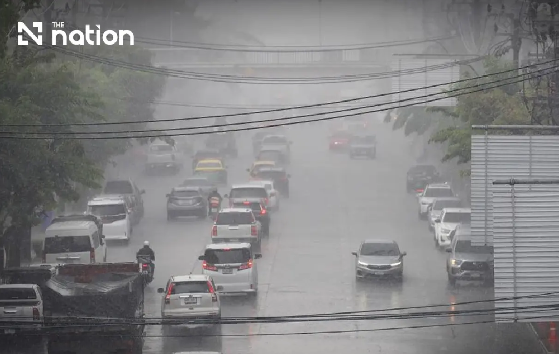
Thailand's meteorological agency has escalated warnings as a powerful monsoon system bears down on the nation's northern and northeastern territories, creating dangerous conditions for residents and travellers throughout the remainder of the week. The Thai Meteorological Department issued its ninth alert on Wednesday evening, signalling the escalating severity of weather patterns that could trigger widespread inundation in vulnerable areas. The advisory remained in effect through Friday, with particular emphasis on communities situated near water sources, hillsides and elevated drainage zones that are susceptible to rapid runoff during heavy precipitation events.
The atmospheric setup driving this severe weather stems from a combination of converging weather systems that have established themselves across Southeast Asia. A monsoon trough has positioned itself squarely over the northern territories and extending into the upper northeastern sectors, while simultaneously a notably vigorous southwest monsoon circulation dominates the maritime regions encompassing the Andaman Sea and surrounding waters. These overlapping patterns create an environment conducive to sustained heavy rainfall, particularly during afternoon and evening hours when convective activity typically peaks. The meteorological configuration suggests that accumulated precipitation from preceding days will compound the flooding risk, making even moderate rainfall potentially problematic in regions already saturated from earlier downpours.
Residents throughout the affected zones face particular vulnerability in specific geographical settings. Foothill communities adjacent to streams and seasonal watercourses remain at highest risk, as topographical features channel runoff rapidly into valleys and populated areas. Similarly, low-lying districts far from natural high ground face inundation from both direct rainfall accumulation and water flowing from surrounding elevated terrain. The department's advisory emphasised the importance of monitoring official forecasts continuously, as weather situations during tropical monsoon seasons can deteriorate quickly and without extensive warning periods. Those planning travel were urged to identify alternative routes bypassing areas with documented flooding histories, as roads through depression zones could become impassable within hours.
The northern region faces particularly intense rainfall prospects, with eight provinces designated for heavy precipitation and a further seven expecting very heavy downpours. Chiang Mai, Chiang Rai, Phayao, Lamphun, Sukhothai, Tak, Kamphaeng Phet and Phichit anticipated heavy rain, while Mae Hong Son, Lampang, Nan, Phrae, Uttaradit, Phitsanulok and Phetchabun faced risks of very heavy accumulations. Thunder activity was forecast to affect over eighty percent of the northern territory, concentrated primarily during the thirty-six-hour window from Wednesday evening through Thursday afternoon. Temperature ranges would remain relatively warm despite the precipitation, fluctuating between twenty-two and twenty-seven degrees Celsius at night and rising to twenty-eight through thirty-four degrees during daylight hours, with gentle southwesterly winds around ten to twenty kilometres per hour.
Northeastern provinces encountered similarly concerning conditions, with twelve provinces under heavy rain advisories and eight facing very heavy precipitation forecasts. Locations including Nong Bua Lamphu, Chaiyaphum, Khon Kaen, Maha Sarakham, Roi Et, Yasothon, Amnat Charoen, Nakhon Ratchasima, Buriram, Surin, Si Sa Ket and Ubon Ratchathani anticipated heavy downpours, while Loei, Nong Khai, Bueng Kan, Udon Thani, Sakon Nakhon, Nakhon Phanom, Kalasin and Mukdahan braced for very heavy rainfall. The northeast's eighty percent storm coverage mirrored the north's precipitation likelihood, with the same thirty-six-hour concentration period. Temperature patterns proved similar to the northern region, ranging from twenty-two to twenty-five degrees Celsius overnight and twenty-seven to thirty-two degrees during daylight, maintaining the lighter wind regime typical of northeast monsoon seasons.
The rainfall threat extended well beyond these high-risk northern and northeastern zones, encompassing central Thai territories and the eastern provinces. The central region would experience thunderstorms across approximately sixty percent of its expanse, with heavy rain affecting Nakhon Sawan, Phra Nakhon Si Ayutthaya, Lop Buri, Saraburi, Kanchanaburi and Ratchaburi. Daytime temperatures in the central zone would reach notably warmer levels, climbing to thirty-two through thirty-six degrees Celsius, substantially hotter than northern counterparts. The eastern provinces faced thunderstorm coverage across seventy percent of their territory, with heavy precipitation expected in Nakhon Nayok, Prachin Buri, Sa Kaeo, Chachoengsao and Chanthaburi, while the Trat province positioned at Thailand's extreme eastern extremity carried risk of very heavy rain. Wave conditions off the eastern coast would amplify during thunderstorms, reaching two to three metres normally and exceeding three metres during most intense convection periods.
Bangkok and its metropolitan periphery anticipated a comparatively moderate situation compared to outlying provinces, though residents should not dismiss the flooding potential. Roughly sixty percent of the capital region would experience thunderstorm activity, with isolated heavy rainfall affecting some localities. The capital's dense urban infrastructure, featuring extensive drainage systems and developed flood management protocols, generally provides better protection than rural communities, though certain perennially vulnerable districts could still experience temporary flooding. Temperatures within Bangkok would climb to thirty-three through thirty-five degrees Celsius during peak daylight, creating humid and uncomfortable conditions despite the rainfall. Southwesterly winds in the ten to twenty-five kilometre-per-hour range would provide some relief during the hottest periods.
Maritime hazards escalated significantly due to wave generation and storm intensification over open waters. The upper Andaman Sea and upper Gulf of Thailand confronted particularly dangerous conditions, with normal wave heights of two to three metres climbing above three metres during thunderstorm passages. All maritime traffic was instructed to exercise extreme caution and actively avoid identified storm cells. Small fishing vessels and recreational boats operating in the upper Andaman Sea and upper Gulf faced mandatory advisories to remain docked through Friday, preventing potential capsizing or loss-of-vessel incidents. The lower Andaman Sea maintained somewhat calmer conditions with baseline two-metre waves rising beyond two metres in stormy localities, still requiring heightened vigilance from operators of smaller watercraft.
The eastern and southern coastal regions experienced more variable maritime situations depending on specific latitude. Along the eastern South China Sea coast encompassing Phetchaburi, Prachuap Khiri Khan, Chumphon and Surat Thani, thunderstorms would occur across roughly forty percent of the region. North of Surat Thani, southwesterly winds would strengthen to twenty through thirty-five kilometres per hour, generating two to three-metre wave heights and offshore swells exceeding two metres. South of Nakhon Si Thammarat, the southwesterly wind component diminished to fifteen through thirty-five kilometres per hour, creating near-coast waves of approximately one metre and offshore waves reaching one to two metres, though thunderstorm passages could still produce wave heights exceeding two metres.
For Malaysian observers and the broader Southeast Asian region, Thailand's flooding situation carries relevance beyond immediate Thai borders. The same monsoon circulation patterns affecting Thailand routinely extend southward into northern Malaysia, Brunei and Singapore's maritime zones. Travellers transiting through Thailand during this period should remain alert to potential transport disruptions, as inundated roads and overwhelming storm activity could delay land-based journeys significantly. Cross-border water resources shared between Thailand and Malaysia, particularly in major river systems, respond to atmospheric conditions synchronously, suggesting that Malaysian hydrological authorities would likely monitor Thai rainfall intensity as an indicator of potential upstream flow variations. The intensifying monsoon pattern demonstrates the fundamental interconnectedness of Southeast Asian weather systems and the necessity for coordinated regional meteorological awareness during the southwest monsoon season.

