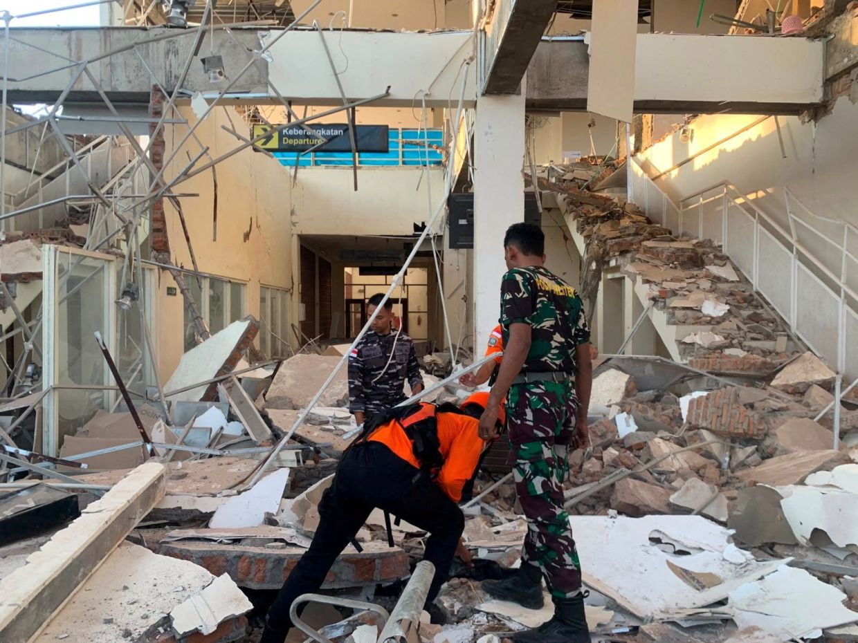
A magnitude 7.7 earthquake struck Indonesia's Flores region in the early hours of Saturday, August 15, unleashing a force that toppled buildings, damaged infrastructure and claimed at least two lives in one of the world's most seismically unstable regions. The tremor, which originated 10 kilometres beneath the ocean floor approximately 68 kilometres north-northwest of the city of Ende in East Nusa Tenggara province, triggered immediate alarm across the island and prompted emergency responses from multiple agencies across several provinces.
Indonesia's Meteorology, Climatology and Geophysics Agency registered the quake at 5:58 a.m. local time and swiftly mobilized tsunami monitoring systems across the vulnerable coastlines of East Nusa Tenggara, West Nusa Tenggara, South Sulawesi and Southeast Sulawesi provinces. Initial evacuation orders directed residents away from beaches and riverbanks towards elevated terrain, a precautionary measure born from the region's traumatic history with sea-generated disasters. However, within hours the agency determined that oceanographic monitoring detected no abnormal sea-level fluctuations that would threaten coastal populations, and the tsunami warning was subsequently rescinded, allowing residents to return to their homes.
The earthquake's shallow depth—a characteristic that typically translates to more intense ground shaking at the surface—meant that communities across much of Flores island experienced severe structural damage. The Maumere Search and Rescue Agency documented at least two fatalities and two injured persons in preliminary reports, though damage assessments were ongoing. Hospital facilities throughout the affected zone, treating both earthquake-related injuries and regular patients, evacuated their buildings as a precaution. Medical staff improvised makeshift outdoor treatment areas, moving beds, intravenous stands and oxygen cylinders beyond the walls of potentially unstable structures to ensure continuity of care during the crisis.
Eyewitness accounts from residents painted a picture of widespread devastation and community disruption. Yohanna Embu, residing in Sikka regency, described how numerous structures across her locality had been damaged by the violent shaking, forcing frightened residents to flee towards higher elevations. She reported witnessing the collapse of the waiting room at the Maumere port terminal, a facility serving one of the region's crucial transportation hubs. The destruction of such public infrastructure underscored the quake's formidable power and raised immediate concerns about supply chains and evacuation logistics in the aftermath.
The St. Peter Major Seminary, a significant Catholic educational institution on the predominantly Catholic island of Flores, bore witness to chaos as morning Mass participants scattered in panic when the roof of the assembly hall gave way. The seminary's rector, Rev. Guidelbertus Tanga, recounted how students and nuns fled desperately beneath collapsing structural elements. The incident resulted in at least one priest sustaining a fractured leg after jumping from the second storey of a building during the violent tremors—a stark reminder of the life-threatening dangers posed by poorly reinforced construction in seismic zones.
The earthquake proved significant enough to generate multiple aftershocks following the initial violent jolt, a pattern typical of major seismic events in subduction zones. These secondary tremors prolonged the period of instability and heightened psychological distress among residents already traumatized by the initial impact. Aftershock sequences can persist for days or weeks, complicating rescue and recovery efforts and keeping emergency services on heightened alert. Engineers and structural assessors face additional challenges in evaluating building safety when additional seismic energy continues reverberating through the affected zones.
Indonesia's geographical position renders it exceptionally vulnerable to seismic activity. The sprawling archipelago of more than 17,000 islands sits astride the Pacific Ring of Fire, an extensive girdle of tectonic instability encompassing numerous volcanoes and fracture zones encircling the Pacific Basin. This location fundamentally shapes the nation's geological destiny, making earthquakes not anomalies but regular features of Indonesian existence. The convergence of multiple tectonic plates in Southeast Asian waters generates continuous stress and energy release, manifesting through frequent earthquakes of varying magnitudes.
The Flores region in particular carries historical weight in Indonesia's earthquake narrative. In December 1992, another powerful seismic event triggered a devastating tsunami that claimed approximately 2,500 lives on Flores and the surrounding southeastern islands, establishing a tragic precedent that haunts collective memory. That catastrophe demonstrated graphically how submarine earthquakes in the region can generate destructive ocean waves with little warning. The August 15 earthquake, occurring in the same general area, inevitably evoked those memories among older residents and officials alike, explaining the swift and cautious response protocols activated by authorities.
For Malaysia and broader Southeast Asia, earthquakes striking Indonesia carry immediate implications for regional stability and cross-border responses. The success or failure of Indonesian disaster management affects regional supply chains, tourism, and diplomatic relations. Malaysian aid agencies, international organizations, and ASEAN mechanisms often coordinate assistance following major disasters. The relatively moderate death toll from this particular earthquake—despite its considerable magnitude—suggests that building codes may have improved since 1992, or that population density in the epicenter region was lower than feared, offering cautiously optimistic lessons for regional disaster preparedness.
The response by Indonesian authorities to lift the tsunami warning based on oceanographic data reflects the evolution of scientific monitoring capabilities in the region. Real-time seismic and tidal instrumentation allows decision-makers to distinguish between earthquakes that genuinely threaten coastal areas and those that, while destructive on land, do not generate significant tsunami potential. This scientific sophistication represents progress in minimizing false alarms that can paralyze commerce and unnecessarily divert resources. Nevertheless, the incident underscores the ongoing challenge of balancing precautionary principles against operational efficiency in disaster management.
As recovery operations commenced in the days following the August 15 earthquake, authorities faced the complex tasks of casualty identification, structural assessment, and psychological support for traumatized communities. The combination of collapsed buildings, damaged hospital facilities, and disrupted transportation networks created compounding challenges for rescue and medical personnel. Engineers would need to evaluate which structures could be retrofitted and which required demolition and reconstruction. For a region already economically challenged and dependent on agriculture and fishing, the interruption caused by seismic disaster represents a significant setback to livelihoods and development trajectories.

