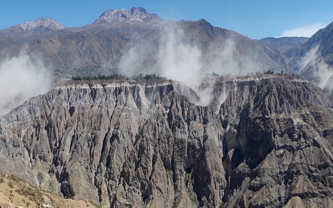
A significant 6.7 magnitude earthquake struck southern Peru on Thursday afternoon, rattling communities across multiple regions and reaffirming the country's vulnerability to powerful seismic events. The US Geological Survey confirmed the tremor's strength, while Peru's Geophysical Institute (IGP) recorded the event at 1 pm local time with a somewhat higher magnitude of 7.2, located approximately 35 kilometres north of Coracora in Parinacochas province within the Ayacucho department. The distinct readings highlight how different measurement methodologies can yield varying assessments of seismic magnitude, a phenomenon that underscores the complexity of earthquake monitoring in tectonically active regions.
The depth at which the earthquake occurred proved to be a crucial factor in limiting surface damage and casualties. At 108 kilometres below the surface, the tremor struck at an intermediate depth rather than shallow crustal levels, effectively absorbing and dissipating much of the released seismic energy before it could transmit destructive force to populated areas. Geophysicists explained that this depth classification resulted in a Mercalli intensity rating of III-IV, characterised as light to moderate shaking, which accounts for the absence of immediate reports of severe structural failure or loss of life despite the earthquake's considerable magnitude.
The seismic disturbance was widely felt throughout Peru's southern and central regions, with residents in the capital city of Lima—situated considerably to the north—clearly detecting the ground motion. This geographical spread of perceptible shaking demonstrates how intermediate-depth earthquakes can transmit energy across vast distances more effectively than shallow events, allowing populations far removed from the epicentre to experience noticeable tremors. The widespread sensation underscores how earthquake preparedness messaging reaches beyond immediate danger zones to affect public consciousness and behaviour across entire nations.
For Malaysia and Southeast Asia, Peru's experience offers instructive lessons about seismic risk management and disaster response. The region's advanced monitoring capabilities through institutions like the IGP and its specialized seismic centre CENSIS provide a model for comprehensive earthquake surveillance. Southeast Asian nations situated along tectonic boundaries, including parts of Indonesia, the Philippines, and Timor-Leste, face comparable geological challenges and could benefit from Peru's integrated approach combining sophisticated detection networks with coordinated public information systems.
The timing of this earthquake reflects a broader pattern of intensified seismic activity across Peru's northern and southern territories. Geologists attribute this heightened tremor frequency to Peru's position along the Pacific Ring of Fire, a zone of exceptional geological instability encircling the Pacific basin where the vast majority of the world's earthquakes and volcanic eruptions occur. Peru's specific location along subduction zones where oceanic plates descend beneath continental plates creates conditions for frequent seismic events, making earthquake preparedness an integral component of national infrastructure and public policy.
Historical context proves essential for understanding Peru's seismic environment and the relatively benign outcome of Thursday's earthquake. The 2007 Ica earthquake, which registered 7.9 magnitude, devastated the region and killed nearly 600 people, demonstrating how geological factors beyond magnitude alone determine earthquake casualties. Shallower depth, urban density, building construction standards, and response infrastructure all influence whether a seismic event becomes merely notable or genuinely catastrophic. The 2007 disaster shaped Peru's subsequent investment in earthquake monitoring, building codes, and public education programmes.
Peruvian authorities responded to Thursday's earthquake with measured guidance aimed at maintaining public vigilance without inducing unnecessary panic. The Geophysical Institute urged residents to review household evacuation protocols, maintain awareness of safe shelter locations, and prepare emergency supply kits containing essentials for potential displacement. This communication strategy reflects the balance disaster management agencies must strike between promoting preparedness and avoiding the psychological fatigue that excessive alarm-raising can produce among populations experiencing frequent minor earthquakes alongside rare major events.
The absence of immediate casualties and significant damage reports represents a positive outcome that nevertheless should not diminish preparedness efforts. Peru's experience illustrates how geological fortune—in this case, favourable depth and ground conditions—can prevent disasters, but such good fortune cannot be relied upon indefinitely. The next major earthquake could strike at shallow depth in a heavily populated zone, with potentially catastrophic consequences. This awareness explains why authorities maintain emphasis on preparation despite successful navigation of individual seismic events.
For regional context, Southeast Asia's own position within the Ring of Fire makes Peru's earthquake management approaches particularly relevant. Indonesian, Philippine, and Malaysian policymakers monitor international seismic events and disaster responses, incorporating successful strategies into their own frameworks. The interplay between magnitude, depth, distance from populated centres, and building resilience that shaped Thursday's benign outcome in Peru applies equally to potential earthquakes affecting Malaysian territories or neighbouring nations. Understanding how different seismic parameters produce different human consequences helps governments prioritise investments in monitoring, infrastructure hardening, and public education.
Looking forward, Peru's continued experience along a major subduction zone means further powerful earthquakes remain inevitable rather than merely possible. The IGP's ongoing monitoring and recent emphasis on public preparedness reflect institutional learning from past disasters. For Malaysia and the broader Southeast Asian region, Peru's approach to integrating scientific monitoring with community preparation provides a tested model worth emulating as countries work to reduce earthquake-related casualties and economic losses in increasingly urbanised and interconnected societies.

