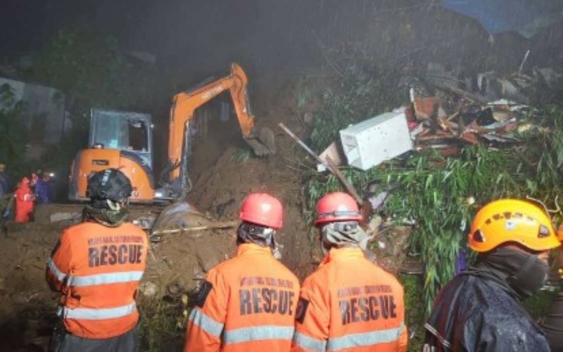
The Philippines faces a mounting humanitarian crisis as authorities confirmed that 19 people have perished following a severe weather system combining Tropical Depressions Luis and Maymay with the southwest monsoon. According to the country's Office of Civil Defence, the cascading natural disaster has displaced approximately 2.2 million individuals across a wide geographic footprint spanning ten distinct regions, from the northern Ilocos to the southern Zamboanga Peninsula. The scale of the emergency underscores the vulnerability of the Philippines' sprawling archipelago to tropical weather systems that strike during the monsoon season.
The fatalities were concentrated in mountainous and low-lying areas most susceptible to flooding and landslides. Benguet, a highland province in the Cordillera Region, suffered the highest death toll with 12 confirmed deaths, followed by Rizal in the National Capital Region with four fatalities and Batangas in the Calabarzon area with three. These disparate locations suggest that the weather system's impacts were indiscriminate, affecting both urban and rural communities with equal ferocity. The geographic spread of casualties reflects how successive weather phenomena can compound impacts across multiple weather systems and topographical zones.
Beyond fatalities, the disaster has left additional casualties and missing persons in its wake. The Office of Civil Defence documented 15 injured individuals distributed across Benguet, Ilocos Sur, Rizal and Cavite, indicating that rescue and medical response operations remained ongoing at the time of the official assessment. Four people were reported missing, with three in Benguet and one in Batangas, raising concerns that the final casualty count might yet increase as search and rescue teams continue their operations in affected areas. These figures paint a picture of ongoing emergency response at multiple levels.
The human displacement resulting from the weather events has been extraordinary in scale. Nearly 647,000 families totalling 2.27 million people have experienced some form of disruption to their normal lives, whether through evacuation, property damage, or loss of livelihoods. The affected regions represent a cross-section of the Philippines' economic geography, encompassing the agricultural heartlands of Central Luzon and the Bicol Region, the industrial zones of Calabarzon surrounding Manila, and the less developed but densely populated Cordillera and Mimaropa areas. This widespread impact suggests that the economic consequences will extend well beyond the immediate disaster zone.
Emergency sheltering operations have mobilised substantial resources to accommodate those unable to return to their homes. Authorities established approximately 919 evacuation centres that collectively housed over 26,000 families or roughly 95,000 individuals at the peak of the crisis. These centres represent a significant logistical undertaking, requiring coordination between local government units, national disaster agencies, and community organisations to provide basic necessities, sanitation facilities, and medical care. The scale of evacuation centre operations indicates that many residents faced conditions severe enough to render their homes uninhabitable.
Physical destruction to residential infrastructure compounded the displacement challenge. Official damage assessments documented 639 houses sustaining various degrees of damage, with 45 structures completely destroyed and rendered uninhabitable. Given that the Philippines faces recurring typhoon and monsoon seasons, such damage represents not merely temporary inconvenience but potentially permanent displacement for vulnerable households lacking insurance or savings for reconstruction. The destruction of 45 homes entirely suggests that in at least these cases, residents would require government assistance or charitable support for rebuilding.
Agricultural damage created secondary economic pressures across rural communities. The preliminary assessment valued crop losses and damage to farming infrastructure at PHP135.33 million, a substantial sum for a nation where agriculture employs millions and provides food security for a growing population. Flooding and landslides in agricultural regions can destroy not only standing crops but also irrigation systems, storage facilities, and livestock, requiring years of recovery for farming communities. The monsoon and tropical depression impacts thus threaten the 2024 harvest cycle and potentially extend into subsequent planting seasons.
Infrastructure damage extended beyond residential and agricultural sectors. Officials estimated direct infrastructure damage at PHP1.46 million, encompassing roads, bridges, electrical systems, water supply networks, and other public works. Such damage disrupts economic activity by isolating communities, interrupting commerce, and creating cascading failures in essential services. For a region as geographically dispersed as the Philippines, infrastructure rehabilitation becomes a critical determinant of how quickly affected populations can return to normal economic activity and livelihood restoration.
The convergence of multiple weather phenomena—two separate tropical depressions plus the monsoon system—created compounding hazards that overwhelmed typical dry-season patterns. The southwest monsoon, a seasonal meteorological feature, combined with discrete tropical cyclonic systems to produce rainfall intensities and wind speeds exceeding what single weather events might generate. This superposition of weather hazards represents a climate change adaptation challenge for the Philippines, which must prepare emergency response systems for potentially intensifying or more complex weather scenarios. The August timing placed the crisis during the peak of the southwest monsoon season, when the Philippines' western coasts and inland regions face elevated atmospheric moisture and instability.
For Malaysia and broader Southeast Asia, the Philippine disaster carries important implications regarding regional preparedness and climate resilience. The Philippines and Malaysia share similar tropical maritime geography, seasonal monsoon patterns, and vulnerability to tropical cyclones, suggesting that lessons learned from the Philippine response could inform Malaysian disaster management protocols. Both nations must balance rapid emergency response mobilisation with medium-term recovery planning, particularly regarding vulnerable populations in mountainous terrain or densely settled lowlands prone to flooding. The scale of displacement and infrastructure damage demonstrates how weather disasters can rapidly overwhelm local resources and necessitate national coordination.
The disaster also highlights the importance of pre-positioned emergency resources and pre-arranged agreements for regional mutual assistance. As climate change potentially alters cyclone intensities and monsoon precipitation patterns, Southeast Asian nations face growing pressure to upgrade early warning systems, improve building codes in hazard-prone areas, and establish more resilient agricultural practices. The Philippines' experience managing 2.2 million displaced persons and coordinating nearly 900 evacuation centres provides operational insights for regional emergency management networks, demonstrating both the efficacy of rapid deployment protocols and the limitations of resources in truly catastrophic scenarios.

