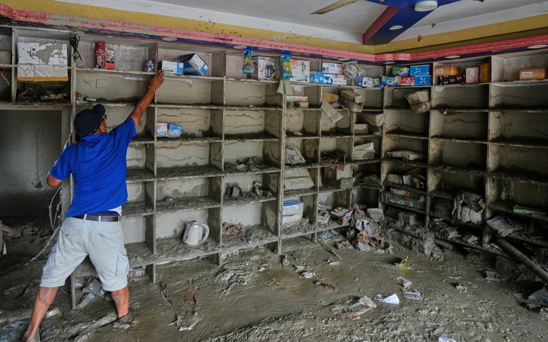
Authorities in southwest China's Xizang Autonomous Region have confirmed that a devastating mudslide devastating Gyirong Port on August 26 originated from a glacier failure on the Nepalese side of the Himalayan border. The disaster, which has claimed 16 lives and left 546 others unaccounted for as of Saturday evening, represents a sobering reminder of how climate-driven environmental hazards in Asia's high mountains pose transboundary risks that extend far beyond individual nations.
The calamity began high in the Himalayan peaks when a glacier on the south slope of Mount Langtang Lirung in Nepal fractured at approximately 5,200 metres above sea level. This rupture released a massive volume of ice and rock that accelerated rapidly downslope, cascading across the international frontier between Nepal and China's Xizang region. The initial avalanche, which would have travelled at tremendous speed through the thin mountain air, represented the first stage of what became an increasingly destructive chain of natural disasters.
As the avalanche material descended to around 4,000 metres elevation, the dynamics fundamentally shifted. The falling ice and rock began gouging and scouring the mountainside itself, dislodging additional material and mixing with soil and water to transform into a massive debris flow. This is a critical distinction in mountain hazard science: the initial avalanche merely triggered a secondary but far more destructive phenomenon. The resulting mudslide possessed tremendous volume and velocity, carrying enormous quantities of rock, soil, vegetation, and water in a churning mass that behaved almost like a fluid.
This debris flow maintained devastating momentum as it descended the valley floor, travelling approximately 22 kilometres before arriving at Gyirong Port, located at roughly 1,800 metres elevation. The journey across this distance allowed the mudslide to accumulate even more material and energy, transforming it into one of the most destructive natural disasters to strike the region in recent memory. Upon impact, the mudslide obliterated an area spanning approximately 0.7 square kilometres, completely demolishing 27 buildings and associated infrastructure.
The scientific confirmation of the disaster's origins came from the cryosphere emergency disaster response team operating under the Institute of Mountain Hazards and Environment, which operates under the Chinese Academy of Sciences. Their investigation combined sophisticated remote-sensing monitoring data with field-transmitted sensor information and comprehensive on-site surveys. This multi-layered analytical approach allowed experts to trace the disaster's origins definitively to the Mount Langtang Lirung glacier, establishing a clear transboundary causal chain.
The incident underscores mounting concerns about glacier stability across the Hindu Kush-Himalayan region, where warming temperatures are accelerating the destabilisation of ancient ice masses. Mount Langtang Lirung, which straddles the Nepal-Tibet border, has been subject to increasing scientific scrutiny precisely because of its vulnerability to catastrophic failure. The glacier that triggered this disaster had been monitored, yet the rapidity and magnitude of its collapse appear to have exceeded previous expectations among researchers.
For Malaysia and other Southeast Asian nations, this tragedy carries important implications regarding regional disaster preparedness and climate adaptation. While Southeast Asia's geography differs significantly from the high Himalayas, the region faces its own mountain-related hazards that could intensify as climate patterns shift. Malaysia's own highland regions, particularly in Peninsular Malaysia and Sabah, experience seasonal flooding and landslides that share underlying mechanisms with this Himalayan disaster.
The transboundary nature of this catastrophe also highlights the necessity for enhanced cooperation between Nepal and China on environmental monitoring and disaster warning systems. When natural hazards originate in one nation but impact another, effective prevention requires genuine collaborative frameworks that extend beyond diplomatic courtesy. The mountainous regions shared by Nepal and China require integrated monitoring networks and rapid information-sharing protocols to provide populations downstream with crucial warning time.
The scale of the disaster—16 confirmed deaths with 546 individuals still missing—suggests that the actual toll may increase substantially as rescue operations continue and missing persons are accounted for. Mudslide disasters in mountainous terrain present extraordinary challenges for rescue teams, as the debris often buries victims beneath metres of compacted material. Access to remote areas like Gyirong Port further complicates emergency response efforts, requiring specialised equipment and trained personnel.
This incident also raises questions about settlement patterns in high-risk mountain zones across Asia. Gyirong Port serves as a transboundary trading hub and transit point between Nepal and China, making it essential to economic activity in the region despite its hazardous location. Similar tension exists globally between economic necessity and environmental risk, yet this disaster demonstrates that proximity to glacial zones represents a quantifiable and potentially escalating threat.
Climate scientists have increasingly warned that glacier-related disasters will intensify throughout Asia as atmospheric warming accelerates ice loss in the Hindu Kush-Himalayan system. The frequency of such events may increase even as individual glaciers retreat to lower elevations, as destabilisation of remaining ice masses becomes more common. The August 26 mudslide in Gyirong Port may represent a preview of hazards that could become more routine across the greater Himalayan region in coming decades.
The investigation by Chinese authorities provides valuable scientific data that will enhance understanding of how glacier failures transition into debris flows and ultimately mudslides. This knowledge could inform risk assessment protocols and early warning systems throughout the region. For populations living downstream of major glaciers in Nepal, Tibet, and other Himalayan regions, such research represents essential information for building resilience against future disasters.

