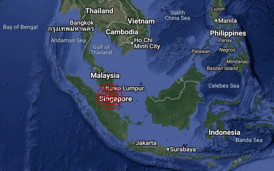
A minor earthquake registering 3.1 on the magnitude scale occurred in the waters off the coast of Batu Pahat in Johor on August 25, with the seismic event unfolding at 4.12 pm local time. The Malaysian Meteorological Department, commonly referred to as MetMalaysia, confirmed the incident through an official statement released by its National Weather and Earthquake Operations Centre, providing reassurance to residents and relevant authorities across the region.
According to MetMalaysia's technical assessment, the earthquake's epicentre was positioned at geographical coordinates 1.7 degrees north latitude and 102.8 degrees east longitude, placing the origin point approximately 18 kilometres to the south-west of Batu Pahat town. This offshore location meant that the tremor, while detectable by sensitive monitoring equipment, would have had minimal direct impact on populated areas in the district or surrounding municipalities.
The 3.1-magnitude classification places this seismic event firmly in the weak category, far below the threshold where structural damage to buildings typically occurs. For context, earthquakes in this range are generally felt only by sensitive instruments and perhaps by individuals in quiet indoor environments near the epicentre, but they rarely cause any noticeable disruption to daily life or pose hazards to infrastructure. This particular tremor in Batu Pahat waters represents the type of minor geological activity that regularly occurs throughout the Southeast Asian region without drawing widespread public concern.
MetMalaysia's swift clarification that no tsunami threat exists to Malaysia carries particular significance for a maritime nation with extensive coastlines and significant port operations. The absence of a tsunami risk means that coastal communities, fishing operations, and maritime traffic in the Straits of Johor and surrounding waters could proceed without any precautionary measures or disruptions. This reassurance is important for maintaining normal economic activity and public confidence in coastal regions.
The offshore location of the epicentre distinguishes this incident from seismic events occurring on land or in shallow coastal waters, where tsunami generation becomes a more serious concern. Johor's position along the southwestern coast of Peninsular Malaysia places it within a seismically active zone of the Southeast Asian region, though major earthquakes remain comparatively rare compared to countries situated directly atop major tectonic boundaries.
MetMalaysia's monitoring infrastructure plays a crucial role in detecting and disseminating information about seismic activity affecting Malaysian territory and surrounding waters. The agency's rapid response in confirming the earthquake's parameters and addressing public safety concerns demonstrates the operational readiness of Malaysia's earthquake monitoring systems. This capability proves essential for a nation where coastal development, maritime industries, and tourism depend on reliable geological hazard assessments.
From a broader regional perspective, the Johor earthquake contributes to the ongoing dataset that seismologists use to understand the tectonic characteristics of this part of Southeast Asia. The Batu Pahat area sits within a zone of moderate seismic activity, though the region is not considered among the world's most earthquake-prone areas. Understanding the frequency and magnitude of tremors helps scientists refine hazard maps and building codes applicable across Malaysia's states.
For residents and businesses in Batu Pahat and nearby districts, such minor seismic events typically pass without comment unless they occur at unusual times or become subjects of media attention. The public's relative unfamiliarity with earthquakes compared to neighbouring countries like Indonesia or the Philippines reflects Malaysia's generally stable tectonic situation. Nevertheless, maintaining public awareness and periodic earthquake preparedness remains prudent risk management.
The incident underscores the importance of maintaining investment in seismic monitoring networks and trained personnel capable of rapidly analysing earthquake data and communicating findings to civil protection authorities. Malaysia's commitment to this infrastructure supports broader disaster risk reduction objectives across the nation and contributes to regional information-sharing arrangements that benefit other Southeast Asian countries facing similar geological hazards.
Looking forward, MetMalaysia continues its routine monitoring of seismic activity, recording all detectable earthquakes for scientific analysis and public safety purposes. While this particular tremor in Batu Pahat waters posed no immediate threat, the accumulated record of such events helps authorities and scientists build comprehensive understanding of Malaysia's geological character and improve preparedness for larger, more consequential earthquakes should they occur.

