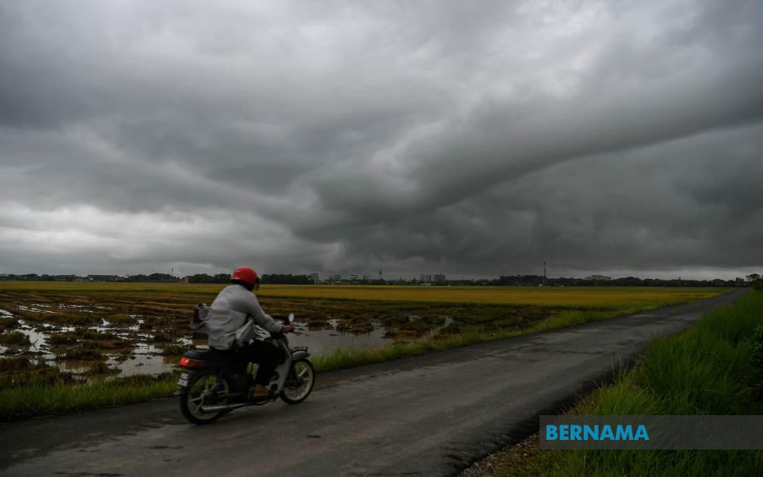
The Malaysian Meteorological Department (MetMalaysia) has activated weather warnings across a broad swathe of the country, alerting residents in multiple states to prepare for potentially dangerous atmospheric conditions. The alert, which remains in effect until 9 pm, encompasses thunderstorms accompanied by intense rainfall and gusty winds that could disrupt daily activities and pose risks to communities across the peninsula, East Malaysia and federal territory.
In the northern region, Kedah residents in Kuala Muda, Baling, Kulim and Bandar Baharu face the brunt of the warning, while neighbouring Penang has issued similar alerts for its northeastern districts and all three divisions of Seberang Perai. These densely populated areas, which include major commercial and residential zones, are particularly vulnerable given their topography and existing drainage infrastructure constraints during heavy precipitation events. The simultaneous warning across both states suggests a cohesive weather system moving through the northwest corridor.
Perak's interior and coastal plains have also been placed on alert, with MetMalaysia identifying Kerian, Larut, Matang and Selama, Hulu Perak, Kuala Kangsar, Kinta, Kampar and Batang Padang as affected districts. The inclusion of both highland areas like those bordering Hulu Perak and low-lying regions indicates the weather disturbance spans considerable elevation variations. Notably, the entire state of Kelantan faces similar conditions, a significant inclusion given the state's historical vulnerability to flooding during heavy monsoon activity and localised thunderstorm events.
The east coast coverage extends across both Terengganu and Pahang, with MetMalaysia flagging Besut, Hulu Terengganu, Kuala Terengganu, Marang, Dungun and Kemaman in the former, and Cameron Highlands, Lipis, Jerantut, Kuantan, Pekan and Rompin in the latter. This breadth of coverage suggests meteorologists have identified atmospheric instability affecting the entire eastern seaboard, a pattern commonly associated with convergence zones or monsoon-related moisture influx. Cameron Highlands, situated at elevated altitude, may experience particularly violent thunderstorm activity typical of upland areas during such weather systems.
In the south, Johor's warning encompasses eight districts stretching from the inland towns of Tangkak and Segamat through the central corridor of Muar, Kluang and Kulai to the eastern coastal regions of Mersing and Kota Tinggi, and down to the major urban centre of Johor Bahru. This comprehensive coverage of Johor underscores the geographic extent of the weather system, affecting agricultural regions, transportation hubs and densely populated urban areas simultaneously. Residents and commuters in these zones should exercise heightened caution given potential impacts on road conditions and visibility.
Sarawak's designation includes several divisions spanning the state's geography, from the central regions of Sibu and Mukah through to the outlying districts of Kapit and the northern coastal area of Miri. The specific notation of sub-districts such as Matu and Dalat within Mukah, Song within Kapit, Tatau within Bintulu, and Beluru and Marudi within Miri indicates MetMalaysia's detailed assessment of localised vulnerability. This granular approach reflects operational protocols designed to guide targeted public communications and emergency response measures in East Malaysia's complex terrain.
In Sabah, the warning bifurcates between the Interior Division—covering Sipitang, Kuala Penyu, Beaufort and Tambunan—and the West Coast Division, which encompasses Papar, Penampang and Ranau. The Federal Territory of Labuan, positioned strategically between Sabah and Brunei, also faces the incoming weather system. These areas, particularly the interior divisions and highlands, experience distinct weather patterns influenced by Borneo's topography, making targeted forecasting essential for communities often isolated by terrain and weather.
Thunderstorm warnings of this geographic scope carry significant implications for Malaysian economic activity and public safety. Transportation networks, including highways, railways and maritime routes across affected regions, may experience disruptions from reduced visibility, waterlogged routes and hazardous driving conditions. The warning's emphasis on strong winds alongside heavy rain suggests potential for localised flash flooding, particularly in low-lying areas and those with drainage limitations—a recurring challenge for Malaysian municipalities during high-intensity precipitation events.
Public utilities and infrastructure also face vulnerability during such weather episodes. Electrical distribution networks may experience service interruptions from lightning strikes or wind damage, while water supply systems in some areas might be compromised. Agricultural activities across the peninsula and East Malaysia could face losses if the storms persist or intensify, particularly affecting crops in their growth phases and open-field operations unable to shelter from severe conditions.
Residents in affected areas are typically advised to avoid unnecessary travel, secure loose outdoor items that could become projectiles in strong winds, and remain alert to flood warnings issued by relevant state authorities. Schools and institutions may consider contingency plans depending on weather intensity at critical times. Real-time monitoring by MetMalaysia throughout the warning period enables updated guidance as the system evolves, with the evening deadline suggesting anticipated atmospheric stabilisation as daylight hours conclude.
The breadth of this warning reflects modern meteorological capabilities in detecting and communicating significant weather threats across Malaysia's diverse geographic and climatic zones. For residents across the peninsula and East Malaysia, such alerts represent critical tools for preparation and risk mitigation during periods when atmospheric conditions create hazards for communities, infrastructure and economic operations.

