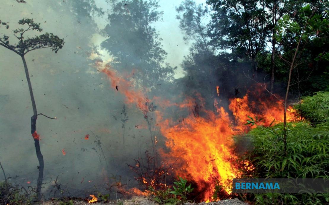
Malaysia's fire crisis has intensified dramatically in the first seven months of 2025, with the Malaysian Fire and Rescue Department (JBPM) recording 18,432 cases of open burning involving forests, shrubland and waste materials—a sharp escalation that nearly doubles the 9,941 incidents documented during the corresponding period in 2024. The year-on-year surge signals a worsening trend that has prompted the nation's fire authorities to elevate their alert status and redirect resources toward prevention and rapid response mechanisms.
According to JBPM director-general Datuk Seri Nor Hisham Mohammad, the current figures also eclipse the 16,294 cases recorded during the same seven-month window in 2023, underscoring a troubling trajectory of increasing fire incidents across multiple years. This escalating pattern has become a matter of considerable concern for policymakers and disaster management officials, who recognise that uncontrolled open burning not only poses immediate threats to lives and livelihoods but also carries broader environmental and public health ramifications that ripple across Southeast Asia during transboundary haze episodes.
In response to the mounting challenge, JBPM has initiated a targeted surveillance and prevention strategy, designating 183 locations nationwide as high-priority monitoring zones based on historical burning patterns spanning the past five years. This data-driven approach reflects a shift toward predictive risk management, enabling fire authorities to pre-position resources and personnel in areas where open burning activity has traditionally clustered. The department's decision to concentrate on these specific locations demonstrates an acknowledgment that fire incidents are not randomly distributed but tend to recur in vulnerable regions characterised by particular combinations of vegetation type, human settlement patterns, and access challenges.
Within this broader monitoring framework, JBPM has identified 62 locations as posing an exceptionally severe threat, characterised by the potential for large-scale fires capable of engulfing areas exceeding 25 hectares. The distinction between routine and catastrophic fire scenarios is operationally crucial; fires of this magnitude can overwhelm conventional firefighting capacity, strain inter-agency coordination, and create cascading difficulties in evacuation and resource mobilisation. Nor Hisham emphasised that these 62 zones demand intensive, round-the-clock scrutiny to prevent uncontrolled conflagrations that could become regional disasters requiring cross-border assistance and potentially triggering air quality alerts across neighbouring countries.
The geographic distribution of burning incidents reveals concerning concentrations in specific regions. Sarawak currently experiences the most severe active fire situation, with large-scale incidents being documented in Sri Aman and Mukah, areas where vast tracts of peatland and secondary forest create conditions conducive to rapid fire spread and smoke generation. Peninsular Malaysia, whilst recording numerous burning incidents, has generally experienced smaller individual fire events, suggesting that the scale and intensity of the burning problem varies significantly across different ecological zones. This regional differentiation is important for understanding local agricultural and land management practices, population density pressures, and enforcement capacity variations.
Sabah has emerged as another region commanding heightened official attention, a designation rooted in the state's unique physiography and vegetation patterns. The combination of dense tropical forests, steep terrain, and challenging topography means that once fires ignite, they can spread with remarkable speed and prove extraordinarily difficult to suppress through conventional ground-based firefighting techniques. The terrain's ruggedness complicates aerial resource deployment and makes personnel access precarious, transforming fire management into a technically demanding and resource-intensive operation. Analysis of 2024 fire data identified seven major incident locations in the vicinity of Kota Kinabalu, all of which have been incorporated into JBPM's roster of 62 high-risk zones requiring intensified monitoring and preparedness measures.
The underlying drivers of the open burning escalation are multifaceted, though meteorological conditions feature prominently in official analysis. Sustained hot weather patterns in various districts have created atmospheric and soil moisture conditions that increase fire ignition susceptibility and accelerate flame propagation. These climatic influences interact with human behaviour, land clearing practices, agricultural traditions, and waste disposal approaches, creating a complex causation chain that demands interventions spanning multiple sectors including agriculture, environmental management, and public education. The seasonal concentration of burning incidents also suggests linkages to agricultural calendars and land preparation cycles in certain regions.
Antipating future challenges, JBPM leadership has begun positioning the department within a longer-term weather forecasting framework centred on the anticipated Super El Niño phenomenon. Meteorological modelling suggests that the Pacific super-heated water conditions expected to consolidate around November 2025 will generate atmospheric teleconnections that alter precipitation patterns across the Asian-Pacific region starting approximately in late January 2026. Malaysia's geography and position relative to these climate drivers suggest that the third and fourth weeks of January 2026 represent a particularly vulnerable window, potentially bringing extended dry conditions that would exacerbate fire risk across multiple sectors of the nation.
This forward-looking preparedness strategy represents a departure from reactive firefighting toward strategic anticipatory resource planning. By incorporating seasonal climate forecasts into operational scheduling and resource allocation decisions, JBPM aims to enhance pre-positioned capacity precisely when weather patterns are most likely to favour large-scale fire development and spread. The department's focus on early preparation acknowledges the finite nature of firefighting resources—personnel, equipment, and aircraft—and the multiplicative strain that simultaneous large-scale fires would impose on response capacity. Such planning becomes especially critical for a nation vulnerable to transboundary haze, where regional fire contagion can rapidly transform domestic fire management challenges into international environmental incidents affecting air quality across multiple countries and creating diplomatic complexities.
The combination of historical incident data, real-time geographic risk mapping, and forward-looking climate forecasting reflects an evolution in Malaysia's approach to fire management toward evidence-based, integrated frameworks. However, the successful implementation of such strategies depends critically on effective inter-agency coordination, adequate budgetary allocation, community engagement in prevention initiatives, and enforcement mechanisms targeting illegal open burning. The persistence of rising case numbers despite increased official attention suggests that current preventive and enforcement mechanisms may be insufficient relative to the scale of the underlying burning activity, pointing toward the need for more comprehensive examination of root causes and more potent deterrent measures across affected regions.

