Japan faces an intensifying weather crisis this weekend as the Japan Meteorological Agency issued alerts Friday for Typhoon Higos, which is forecast to make landfall over the Pacific-facing regions. The warning comes as heavy precipitation continues battering the country's western and eastern zones, compounding concerns already heightened by the simultaneous approach of Typhoon Mekkhala toward the southwestern Amami region in Kagoshima Prefecture. Meteorological officials are particularly concerned that both systems will bring compounded rainfall to vulnerable areas as they progress across the archipelago over the following 24 to 48 hours.
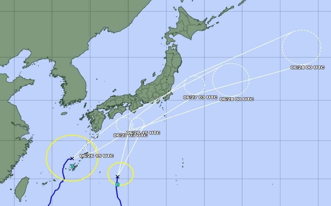
The cascading nature of this dual-typhoon scenario presents unusual challenges for disaster management authorities. While Mekkhala was positioned near Kume Island off Okinawa on Friday morning, moving northeast at 15 kilometres an hour, Higos was expected to approach from the Pacific and potentially transition into the Tokai and Kanto corridors by Saturday. This staggered progression means that areas already saturated by earlier downpours could face renewed heavy rainfall before drainage systems have adequate time to function effectively, dramatically increasing the risk of flash floods and secondary disasters.
As of early Friday morning, the Fire and Disaster Management Agency had issued evacuation orders affecting more than 2 million people distributed across 13 prefectures in the Kinki and Kyushu regions. The scale of this precautionary measure underscores the severity with which authorities are treating the forecast conditions. In the town of Seika, Kyoto Prefecture, municipal officials implemented the highest level 5 emergency safety alert for specific districts after a landslide struck during morning hours, demonstrating that hazardous ground movement had already commenced before the primary typhoon impacts arrived.
Rainfall accumulations recorded over the preceding 72 hours illustrate the extraordinary moisture being channelled into southwestern Japan. The prefecture of Nagasaki experienced 600 millimetres of precipitation in Goto between Tuesday and Friday morning, while Aso in Kumamoto Prefecture and Ureshino in Saga Prefecture each recorded above 500 millimetres. These totals represent roughly the equivalent of an entire month's worth of normal rainfall compressed into less than four days, leaving soil moisture conditions perilously saturated across broad geographical zones.
The anticipated trajectory of both systems will create a particularly dangerous scenario for the Tokai and Kanto regions, where accumulated rainfall is projected to intensify substantially through Saturday. Forecasters predict the Tokai zone could receive up to 300 millimetres of additional precipitation by Saturday noon, while the broader Kanto-Koshin region may accumulate up to 150 millimetres. These projections suggest that areas already experiencing above-average moisture levels face the prospect of rainfall rates potentially exceeding drainage capacity and further destabilising slopes already weakened by preceding deluges.
Japan's meteorological authorities have noted that both typhoons are expected to gradually weaken into extratropical cyclones as they progress across the country's northern latitudes. However, this transition, while reducing maximum wind intensities, typically does not correspondingly reduce rainfall potential—a critical distinction that is central to understanding why tropical systems often produce their most dangerous precipitation patterns during the process of weakening. The cyclonic structure may persist long enough to maintain heavy rainfall even as wind speeds decline, meaning the primary threat to Japanese communities remains water-related rather than wind-related.
The Japan Meteorological Agency has specifically warned of pronounced storm activity across Okinawa Prefecture and eastern Japan, with particular concern for the Kanto metropolitan area, home to Japan's largest concentration of population and infrastructure. The convergence of two weather systems over such a densely populated and economically significant region carries implications extending beyond immediate safety concerns to include potential disruptions to transportation networks, industrial operations, and utilities serving tens of millions of residents.
For Malaysian and Southeast Asian readers, this situation carries particular relevance given the region's own vulnerability to tropical weather systems during monsoon seasons. The Japanese response—including the early evacuation of millions, implementation of emergency alert systems, and detailed rainfall forecasting—demonstrates the infrastructural and institutional capacity that developed nations can marshal against tropical weather threats. Conversely, the fact that even Japan's advanced warning systems and substantial resources cannot eliminate typhoon risks entirely illustrates the inherent challenges posed by such meteorological phenomena.
The dual-typhoon scenario also reflects broader climate dynamics affecting the broader Asian-Pacific region, where atmospheric conditions occasionally align to create multiple tropical systems simultaneously. Understanding how advanced economies manage such compound hazards provides instructive lessons for Southeast Asian nations that frequently face similar meteorological challenges but with more limited institutional and financial resources available for mitigation and response. Japan's decision to prioritize preventive evacuation over reactive rescue demonstrates a risk-management philosophy increasingly adopted across the region's disaster-prone nations.
Authorities have advised the public to remain vigilant regarding secondary hazards including landslide risks, particularly in areas with steep topography or prior slope instability. The combination of elevated soil moisture from preceding rainfall, the additional precipitation anticipated from both typhoons, and the potential for ground shaking should either system's strongest winds arrive during peak rainfall periods creates an environment where cascading failures can occur. Historical records consistently demonstrate that the highest casualty tolls from typhoons in Japan typically result not from direct wind damage but from flooding and landslide-related incidents occurring days after peak winds have subsided.
As the weekend approaches and both Typhoon Higos and Typhoon Mekkhala progress across the Japanese archipelago, the nation's experience will likely provide updated case studies regarding the effectiveness of contemporary forecasting technology, early warning systems, and evacuation protocols when confronted with multiple simultaneous tropical systems. The decisions made by Japanese authorities in the coming hours—particularly regarding resource allocation between competing disaster zones and the timing of evacuation order cancellations—will influence disaster management thinking throughout the Pacific rim and broader Asian region where analogous threats are periodically encountered.