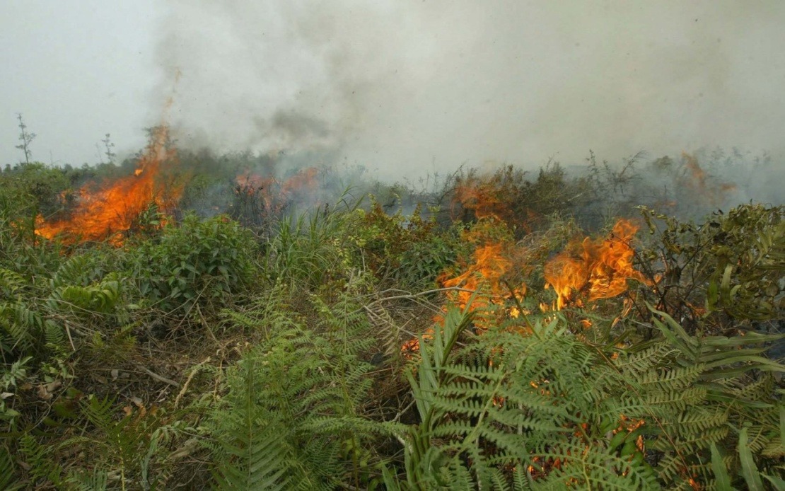
Indonesia is confronting an intensifying forest and land fire emergency concentrated in Kalimantan, where hotspot activity has surged dramatically in recent weeks. The situation has grown particularly severe in West Kalimantan, where monitored hotspots nearly doubled to reach 7,377 on Monday, according to data released by the National Disaster Mitigation Agency (BNPB). This escalation represents a significant jump from preceding measurements, underscoring the speed and scale at which the crisis is unfolding across the region.
According to Berton Panjaitan, acting head of the BNPB's Data, Information and Disaster Communication Centre, the deterioration in West Kalimantan is particularly alarming given the context of broader fire activity. The province experienced an increase of 3,553 hotspots, while the number of active fire spots climbed by 88 to reach 104. More concerning still, atmospheric visibility has plummeted to below one kilometre in affected zones, creating hazardous conditions for residents and hindering both prevention and response efforts. Such reduced visibility typically correlates with dense smoke accumulation and elevated concentrations of particulate matter in the air.
The fire situation across the broader Kalimantan region presents a complex and uneven picture. Central Kalimantan has seen hotspot numbers decline marginally by 147 to 5,244, yet this apparent improvement masks a troubling countertrend—fire spots in the province actually increased by 16 to 72. Similarly, South Kalimantan registered a decrease of 405 hotspots down to 504, but simultaneously saw fire spots rise by 33 to 55. This pattern of declining hotspot counts paired with increasing active fire incidents suggests that while the total number of thermal anomalies may be shrinking, the fires that do ignite are becoming more aggressive and difficult to extinguish.
Sumatra's fire landscape has shifted, with South Sumatra emerging as a growing concern. Hotspots in the province increased by 209 to reach 1,013, representing a worrying trend eastward. By contrast, Riau and Jambi have experienced declining hotspot activity, offering a measure of relief for those provinces. Fire spot counts have generally decreased across all three Sumatran provinces mentioned, suggesting that while thermal anomalies are detected, the transition to active, spreading fires may be somewhat contained compared to Kalimantan. However, this relative stability in Sumatra should not obscure the serious challenges still present across the wider affected region.
The public health dimensions of this crisis demand urgent attention, as the smoke and emissions from these fires pose direct risks to millions of Indonesians. Nearly 5.5 million people are living in areas affected by the fires across both Sumatra and Kalimantan, placing them in the direct path of air pollutants and smoke accumulation. The accumulating toll on respiratory health is already evident in official statistics, with approximately 13,500 confirmed cases of acute respiratory infection (ISPA) recorded cumulatively across July and August. As of Sunday, a significant 4,082 people remained actively suffering from ISPA, indicating that the health crisis is not merely historical but ongoing and current.
Deputy Health Minister Prof Dante Saksono Harbuwono emphasized that this year's health burden from fire-related smoke significantly exceeds that experienced in the corresponding period last year, highlighting both the severity and the comparative worsening of the current situation. Health authorities continue to actively monitor population-level respiratory illness patterns and maintain coordination channels with local health offices to ensure rapid response capacity. The scale of affected population and confirmed cases underscores that this is not an environmental issue confined to forests and land—it represents a direct public health emergency with immediate consequences for millions of people seeking medical care.
Regulatory enforcement has intensified as the Environment Ministry has flagged 42 companies for potential legal action related to fires detected within their concession areas. Environmental Law Enforcement Deputy Rizal Irawan explained that companies were identified through a systematic overlay of satellite-detected hotspot data with official concession boundary maps. Of these flagged companies, 19 are currently undergoing field verification to assess their responsibility and compliance status, while the remaining firms will face inspections in a subsequent phase. This graduated approach balances the need for rapid investigation with the logistical demands of thorough, credible verification.
Crucially, Indonesian environmental law establishes what is termed strict liability for concession holders—meaning companies bear responsibility for fires occurring within their licensed areas regardless of whether the fires were deliberately set or arose through accident or natural causes. This legal framework represents a significant deterrent against negligence and deliberate burning alike. Companies may face either administrative sanctions, which typically involve fines and operational restrictions, or civil liability through compensation claims, creating multiple layers of accountability. Rizal noted that approximately 80 percent of the roughly 2,226 companies that received formal notices last year requiring fire preparedness have since reported their operational readiness, though a concerning minority have yet to respond to government directives.
Transboundary haze coordination has become an increasingly important diplomatic and environmental matter for Indonesia and its neighbours. Following a ministerial-level meeting held in Bali last month involving environment officials from Indonesia, Malaysia, and Singapore, Indonesia has been coordinating haze response and prevention through established ASEAN mechanisms. These international partnerships recognise that smoke and particulate pollution generated by fires in one jurisdiction inevitably spreads across borders, affecting air quality, public health, and economic activity across the region. Malaysia and Singapore have particular interest in such coordination given their geographic proximity to major Indonesian fire zones and their vulnerability to transboundary haze events.
On the prevention front, Indonesia has substantially expanded its community-based fire response infrastructure. Currently, 95 Fire Care Community (MPA) groups comprising approximately 1,425 trained personnel have been established across six fire-prone provinces spanning Sumatra and Kalimantan. Government plans call for an additional 35 groups to be formed before the year's end, representing a meaningful expansion of grassroots fire prevention and early response capacity. These community groups serve as the frontline defense against fire proliferation, combining local knowledge with coordinated training and equipment. The investment in community-level firefighting capacity reflects recognition that centralised government resources alone cannot effectively manage fire risk across vast geographic areas.
The challenges revealed by the current crisis reflect longstanding structural vulnerabilities in Indonesia's fire management system. Despite substantial official efforts at enforcement and community mobilisation, hotspot detection and active fire incidence continue to surge, particularly in West Kalimantan. The gap between declining hotspot counts in some provinces and rising active fire spots suggests that current detection and suppression capabilities may be struggling to keep pace with fire intensity and spread rates. For Malaysia and other regional neighbours, Indonesia's escalating fire crisis carries direct implications—air quality degradation, health impacts, and economic disruption from transboundary haze are not hypothetical concerns but recurring realities that demand sustained regional cooperation and investment in Indonesia's fire management capacity.

