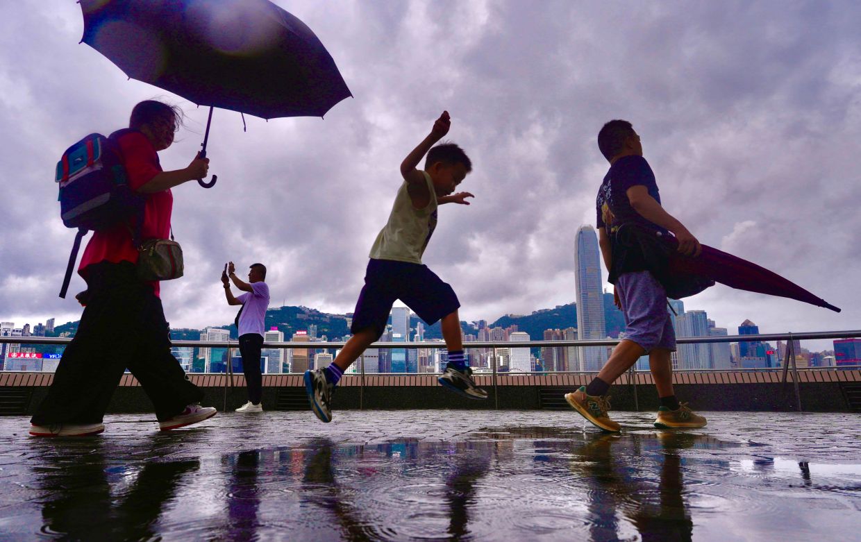
Hong Kong residents finally caught a break from an oppressive week of summer heat on Friday morning as widespread rain moved across the territory, prompting meteorological authorities to activate weather warnings and offering the first meaningful respite from days of relentless temperatures. The Hong Kong Observatory issued an amber rainstorm alert at 8:40 am as showers and thunderstorms swept through various districts, with the warning lifted just three hours later as conditions gradually stabilized throughout the day.
The rainfall arrived at a critical moment for the densely populated territory. The preceding seven days had seen the city gripped by an extraordinary heat event that few could recall. Temperatures in numerous districts had climbed past 34 degrees Celsius, transforming streets and public spaces into challenging environments for residents and workers. The sustained intensity of the heat meant that relief could not come soon enough for a population accustomed to tropical and subtropical conditions but tested by the extremity of this particular episode.
What made this heat wave particularly notable from a meteorological perspective was its persistence rather than isolated spikes. The Hong Kong Observatory recorded maximum temperatures of 33 degrees Celsius or higher for nine consecutive days, a duration that surpassed all previous August records in the city's weather archives. Such consecutive extreme daily temperatures represent a climate signature distinct from the usual summer patterns that characterize Hong Kong's weather systems.
The most dramatic reading came on Sunday, when the observatory registered a peak of 36.9 degrees Celsius, shattering the highest temperature ever reliably recorded in Hong Kong since systematic record-keeping commenced in 1884. This figure was not merely a record for August or for summer, but represented an absolute maximum across all seasons and all months in the territory's documented climate history spanning nearly 140 years. The symbolic weight of breaking a record stretching back to the Victorian era underscored the severity of the event.
Meteorologists attributed the extreme conditions to a combination of atmospheric dynamics operating over the region. Upper-air disturbances, combined with a strengthening southwesterly airstream, had created conditions that both generated the intense heat and, eventually, the relief that arrived on Friday. These upper-atmospheric patterns often drive significant weather changes across Southeast Asia and the broader East Asian region, with knock-on effects felt from the South China Sea to the Korean Peninsula.
The immediate forecast offered a mixed picture for residents planning their weekend activities. Saturday was expected to bring morning thunderstorms in some localities, though sunny intervals would likely emerge as the day progressed. This pattern of intermittent storms followed by clearer periods is typical for the region during the tail end of summer months, when atmospheric instability creates the potential for rapid weather transitions.
For Malaysia and the broader Southeast Asian region, Hong Kong's extreme heat episode carries significance beyond mere meteorological interest. The territory's weather patterns often precede or mirror conditions that move into southern China, Thailand, and occasionally further afield. Record-breaking temperatures in one major Asian financial center can serve as an early indicator of heat stress affecting the wider region, with implications for agricultural productivity, power consumption, and public health across multiple nations.
Authorities in Hong Kong and throughout the region have grown increasingly attentive to the frequency and intensity of heat waves, particularly as climate data suggests a long-term trend toward more extreme temperature events. The nine-day streak and the absolute temperature record represent data points that feed into broader discussions about climate adaptation, building design standards, workplace safety regulations, and emergency preparedness protocols that will shape policy decisions across Asia.
Very hot weather is forecast to return to Hong Kong early in the following week, accompanied by scattered showers. The oscillating pattern of extreme heat punctuated by rainfall represents the region's climatic reality as summer transitions toward autumn. For residents and workers, the cycle means continued vigilance regarding hydration, heat exposure limits, and weather monitoring, as conditions will likely remain challenging even as the absolute peak of the current event passes.
The sequence of events in Hong Kong—extreme heat, meteorological triggers bringing rain relief, and the prospect of renewed warmth—illustrates the increasingly dynamic nature of weather patterns in East and Southeast Asia. For Malaysian observers monitoring regional climate trends and their economic implications, the Hong Kong experience serves as a reminder that heat-related disruptions, whether to transport systems, public health infrastructure, or labor capacity, represent growing considerations for regional planning and development strategies.

