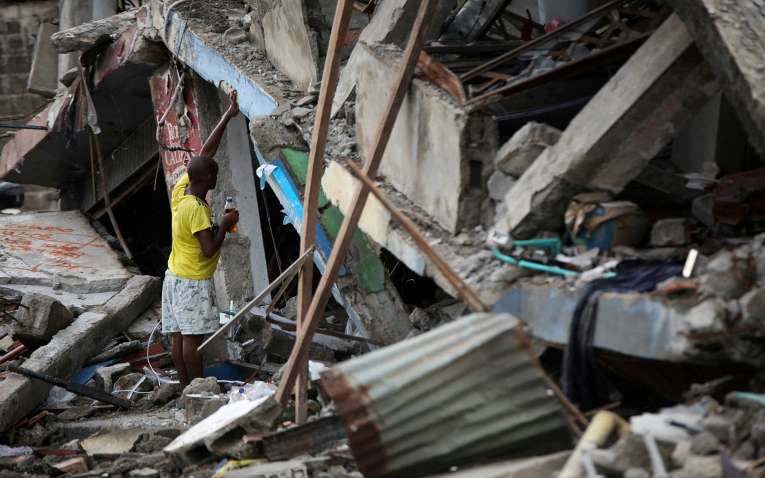
Colombia is grappling with a compounding natural disaster scenario that has pushed the nation's emergency response systems to the breaking point. As recovery efforts continue following a 7.4 magnitude earthquake that struck on August 10, authorities are now confronting an explosive surge in wildfires that has rapidly consumed vast tracts of the country's landscape, forcing a desperate reallocation of already-depleted resources across multiple disaster zones simultaneously.
The scale of the wildfire crisis is staggering. In a single day, the number of municipalities placed under red alert for wildfire threats jumped by 93 per cent, with 344 communities now classified as facing imminent threat from active blazes. This dramatic escalation reflects the severity of conditions gripping the nation, driven by oppressive heat waves and prolonged drought that have left vegetation bone-dry and highly combustible. The Institute of Hydrology, Meteorology and Environmental Studies (IDEAM), Colombia's premier environmental monitoring agency, issued the alert following assessment of atmospheric conditions and fire spread patterns across the country.
The geographic distribution of these fires underscores the nationwide character of the crisis. The National Unit for Disaster Risk Management has identified dozens of active conflagrations concentrated across six major regions: Tolima, Cesar, Norte de Santander, Antioquia, Narino and Santander. Each of these departments represents a significant population centre with agricultural and economic importance, meaning the fires threaten not merely wilderness areas but communities, farmland and infrastructure vital to Colombian society. The concentration of fires across such a broad geographical expanse severely complicates containment efforts, requiring authorities to stretch firefighting resources across thousands of kilometres.
The destruction already inflicted is sobering. Across multiple municipalities, more than 11,000 hectares of land has been charred and devastated, an area equivalent to approximately 27,182 acres. This encompasses destroyed vegetation, agricultural crops that represent livelihoods for farming communities, and residential structures. For a nation still reeling from earthquake damage, this additional loss of habitable structures and productive land creates a cascading humanitarian challenge that will extend far beyond the immediate crisis phase.
The earthquake itself had already inflicted severe damage requiring maximum deployment of emergency resources. The August 10 tremor killed 288 people, injured 4,018 others, destroyed 12,504 homes outright, and left more than 80,000 additional structures damaged. Recovery from such a catastrophe ordinarily demands months of intensive coordinated effort from construction crews, medical personnel, search and rescue teams, and emergency management officials. Instead, these same personnel are now being diverted to firefighting operations, creating dangerous gaps in earthquake recovery activities and preventing the comprehensive rebuilding process the affected communities desperately require.
Emergency responders are stretched dangerously thin. Firefighting crews from multiple departments, including Risaralda—itself heavily impacted by the earthquake—have been mobilised to combat the wildfires, yet authorities have explicitly acknowledged severe staffing shortages. The simultaneous demands of earthquake recovery and wildfire suppression exceed the capacity of Colombia's emergency services. Personnel exhaustion, equipment shortages, and logistical complications compound the challenge of mounting an effective response to either crisis independently, let alone managing both concurrently.
The situation is further complicated by climatic projections that offer little relief in the near term. IDEAM's analysis indicates a 90 per cent probability that El Niño conditions will persist through early 2027, bringing elevated temperatures and intensified heat anomalies particularly toward the end of the current year. This meteorological forecast suggests that the wildfire crisis may persist and potentially intensify rather than abate, transforming this acute emergency into a protracted challenge that will test Colombian resilience for many months ahead.
Adding another layer of complexity to the national emergency is heightened volcanic activity at Purace in the southern department of Cauca. National risk management agencies must simultaneously monitor and prepare for potential volcanic hazards whilst managing earthquake recovery and wildfire suppression. This tri-fold crisis requires authorities to maintain surveillance and preparedness across multiple distinct hazard zones, dividing already-insufficient attention and resources among three separate disaster scenarios. The potential for volcanic activity to trigger additional emergencies creates an additional stress factor that emergency planners must continually assess.
For Malaysia and Southeast Asian observers, Colombia's predicament offers stark reminders of the region's own vulnerability to cascading natural disasters. Like several Southeast Asian nations situated on tectonically active zones and prone to seasonal hazards, Colombia demonstrates how multiple natural disasters can overwhelm even reasonably well-resourced national emergency systems. The Colombian experience highlights the critical importance of pre-disaster planning, international disaster assistance partnerships, and regional cooperation frameworks that can mobilise external support when national capacity proves insufficient. As climate change appears to be intensifying weather extremes and extending drought periods, similar simultaneous multi-hazard scenarios may become increasingly common across vulnerable regions globally, making preparedness and mutual assistance mechanisms ever more essential for national and regional security.

